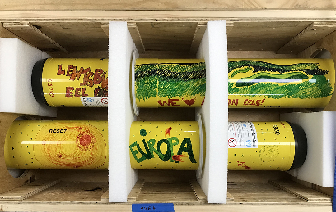
Europa (adopted by Fauquier County Public Schools) and Lewisburg Eel Express (adopted by Lewisburg High School) were two of the first floats deployed in the western North Atlantic. Photo by Andreas Thurnherr
As the researchers and crew aboard the R/V Thomas G. Thompson continue to deploy biogeochemical floats in the western North Atlantic, the arrival of the first profile data marks an exciting step forward for the NSF-funded GO-BGC program.
The first float deployed for the GO-BGC array was adopted by Fauquier County Public Schools in Warrenton, VA, through the Adopt-A-Float program. They named the float Europa after one of Jupiter’s moons with an ocean hidden beneath its icy surface.
For the rest of its robotic life, Europa—and the entire GO-BGC fleet once deployed—will follow a simple but data-rich pattern: drift through the ocean maintaining a depth of about 1,000 meters (3,280 feet) for five to 10 days, drop down to 2000 meters depth (1.2 miles) before returning to the surface, gather data on the vertical ascent, and transmit its findings via satellite at the surface. Europa transmitted the first successful profile about 18 hours after launch. Each float will collect data until its battery dies approximately five years from deployment.
One of the advantages of these floats is their ability to measure the basic biology and chemistry of the ocean. Metrics like oxygen concentration, pH (ocean acidity), nitrate (an essential nutrient for microscopic algae), sunlight (required for algal growth), chlorophyll (an indicator of algal abundance), and particles in the water (including microscopic algae) will give researchers insight into fundamentals of ocean health including primary productivity and growth of phytoplankton, and ocean carbon dioxide uptake from the atmosphere.
“At this point we’re just trying to find out what the baseline metabolism of the ocean is,” said Ken Johnson, a marine chemist at MBARI and principal investigator on the project. “If you go to a hospital, they don’t immediately throw you in the MRI machine, they take your vital signs first.”
The first set of floats are being deployed in the western North Atlantic, a region of particular interest to researchers for its role in regulating heat and exchanging carbon with the atmosphere. Paleoclimate models suggest that global warming has weakened and may continue to weaken the Atlantic Meridional Overturning Circulation (AMOC) that drives the North Atlantic. The GO-BGC array is just one of the tools scientists can use to quantitatively answer whether weakening of the circulation in the North Atlantic—if indeed it is changing—would also impact food webs, ocean respiration, and other fundamental processes.
The researchers and crew aboard the R/V Thomas G. Thompson will deploy a total of 12 floats along the GO-SHIP A20 and A22 lines over the next two months. Although there’s no way of knowing for sure where the floats will drift during their time at sea, tracklines from the existing Argo float array provide some clues about their possible pathways.
They may drift southwest toward the Bahamas or southeast toward the center of the Atlantic. Or they may hitch a ride in the Gulf Stream on a journey to Europe. Whatever their path, these remarkable instruments will be contributing to a more cohesive picture of the global ocean—and how we might expect it to change in the future.
Article by Madison Pobis

The crew prepare to launch the Lewisburg Eel Express.
Photo by Andreas Thurnherr

The 2-leg cruise (60 days-at-sea in total) departed from Woods Hole in March 2021, following the A20 track. Crossing the Gulf Stream, the Sargasso Sea, and towards the South American continental shelf close to French Guiana, the cruise will then head to the Virgin Islands for a brief stop, before proceeding with the A22 line. From the Carribean Sea, the cruise will then head north, ending in Woods Hole in mid-May 2021.