
by George Matsumoto | Sep 18, 2025 | Adopt-a-Float, Outreach
Adopt-a-Float Sticker Contest 2026 Sticker Contest The 2026 Adopt-a-Float Sticker Contest winning entry was created by Shanaya and Chloe at Windemere Ranch Middle School in San Ramon, CA. In our design, we wanted to capture the vibrant colors of the ocean while...
by Jennifer Magnusson | Jan 18, 2024 | Outreach
SOCCOM/GO-BGC Brochure 2024 Click to access full...
by Jennifer Magnusson | Feb 18, 2022 | Adopt-a-Float, Outreach
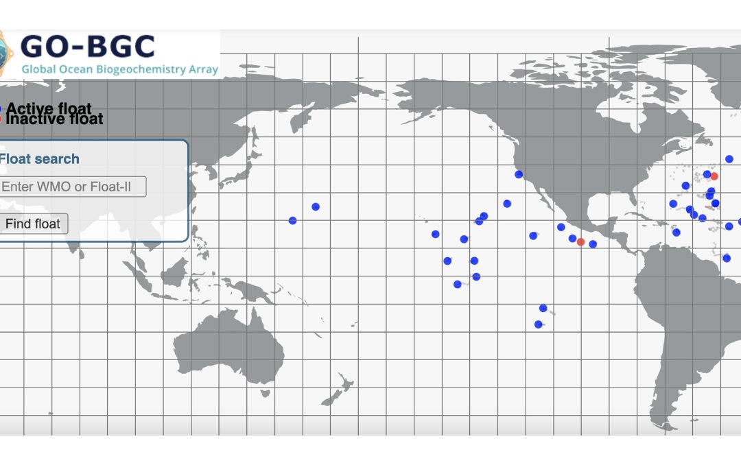
Interactive Float Maps Interactive maps show current locations and trajectories of SOCCOM and GO-BGC biogeochemical floats SOCCOM Interactive Map This interactive map shows current locations and trajectories of SOCCOM biogeochemical floats and provides links to...
by Jennifer Magnusson | Feb 18, 2022 | Adopt-a-Float, Outreach
Adopt-a-Float Tables These tables show all the adopted floats, their names, and their WMO (World Meteorological Organization) number. SOCCOM Adopted Floats Table Table of adopted floats from the SOCCOM project. Schools can use their float’s Adopted Name, MBARI...
by Jennifer Magnusson | Aug 9, 2021 | Lesson Plan
In this activity, students will learn how to use pH testing strips and what pH levels tell us. Lesson Plan pH Data...
by Jennifer Magnusson | Aug 9, 2021 | Lesson Plan
After learning about acidification and how it is affecting the ocean, students will analyze pH levels collected by their float. Lesson Plan Ocean Acidification...