Deploying Drifters
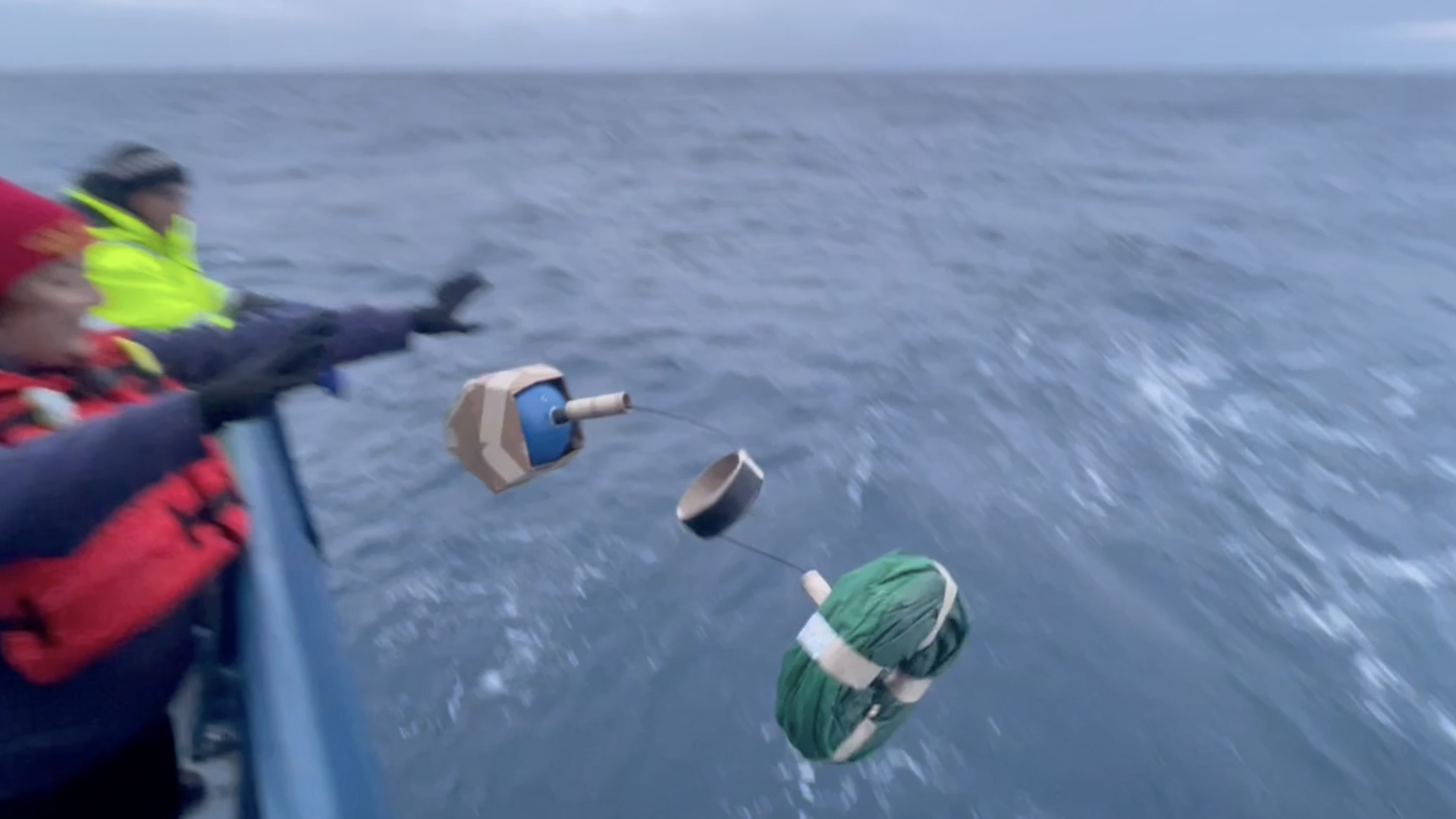
On the last night of the transit, I stayed up late to deploy 10 drifters from the Lagrangian Drifter Laboratory at Scripps. I also stayed up late to watch for aurora borealis. We successfully deployed all 10 drifters but saw zero Northern lights. Everyone was especially bummed about the latter because it was night two of a large solar storm and people as far south as Mexico saw aurora. But there we were, in the Gulf of Alaska and the skies were cloudy. But the science went well, and it was fun to deploy the drifters.
For these deployments, the ship slowed down to 5 knots. SSSGs Ella and Catie, along with A/Bs Chaz, Lance, and Kmart, helped me carry each drifter to the back of the ship. We threw two overboard at each spot, a total of five locations. The instruments measure sea surface temperature and barometric pressure to support better weather forecasts. The drifters are funded by NOAA Global Ocean Monitoring as part of the Global Drifter Program, and the barometers are funded by the NOAA Weather Program Office.
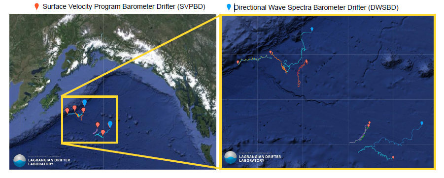
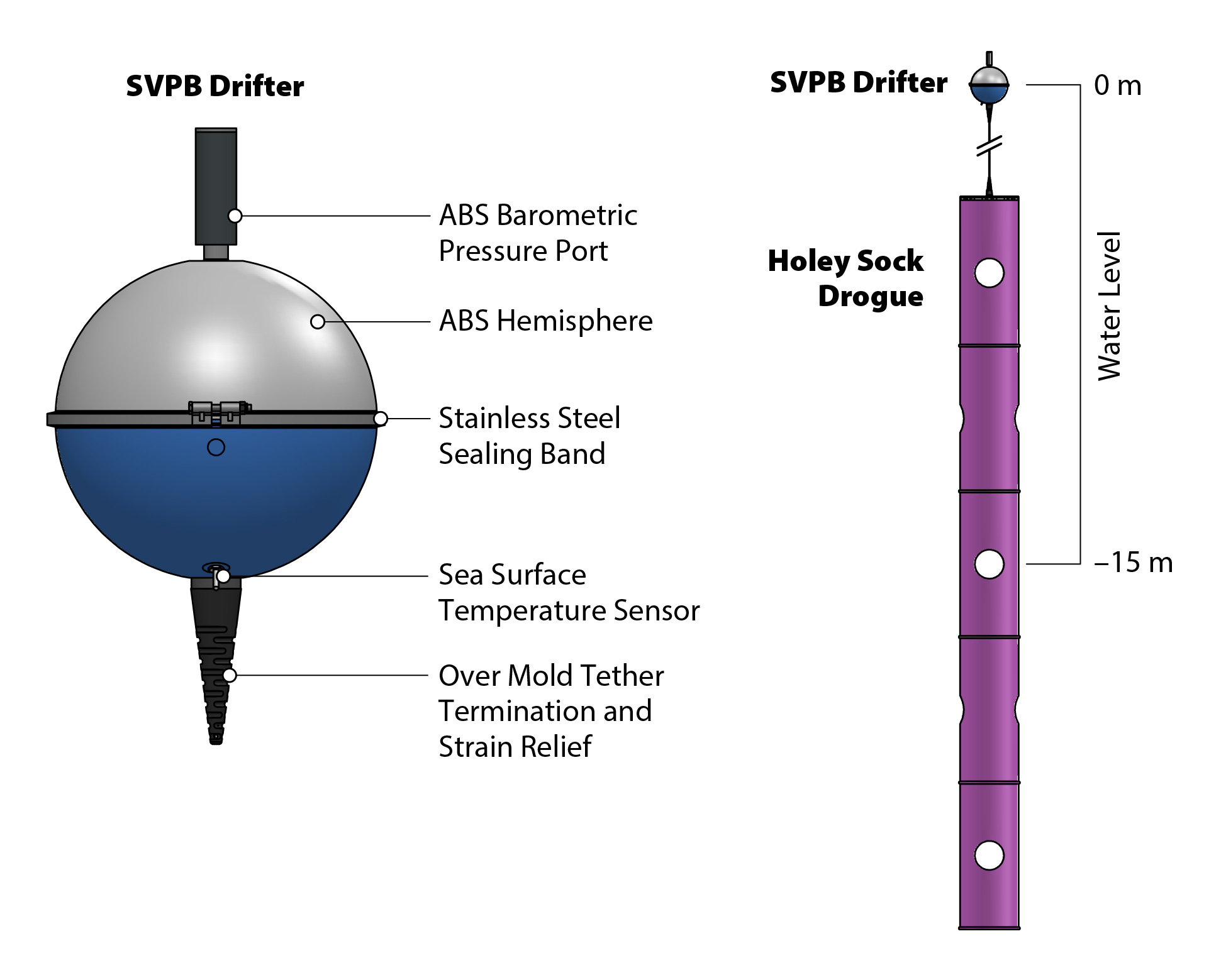
The way the drifters distribute themselves over time also reveals data about ocean currents. Of the 10, eight were SVPB (surface velocity program barometer) drifters that have a drogue, or sea anchor. This keeps them rooted to the ocean current, rather than susceptible to the wind. The other two were DWSBD (directional wave spectra barometer drifters), which don’t have a drogue and can more easily get blown by the wind. If you look at the map below, you’ll notice that there’s three sets of two drifters that are still quite close to each other. Those are instances where we deployed two SVPBs together, they really follow the ocean currents but will hopefully separate more over time. The first and fourth deployments included one of each type of drifter and you can see that they went on different trajectories relatively quickly. That’s because one (the red pins) have that sea anchor and are following ocean currents whereas the other (blue pins) are being moved more by the wind and waves.
This map shows where each of the 10 drifters was a week after deployment from R/V Atlantis.
This whole trip has been a cruise of opportunity, I hitched a ride as R/V Atlantis moved from one port to another in preparation for a research cruise. Other groups, like the NOAA floats and these drifters, had the same idea. Since I was already planning to be onboard, I was happy to take care of their deployments as well. The drifter lab was interested in the Gulf of Alaska for much the same reason as GO-BGC, there haven’t been many deployments in the area and the circulation doesn’t bring floats or drifters up there much. You can check out the updated locations of these drifters, and the thousand or so others in the program, on the real-time map.


